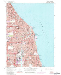
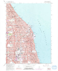
1963 Map of Evanston
USGS Topo · Published 1984About this map
The North Shore communities of Cook County are captured in a period of intense post-war density, where the established residential patterns of Evanston and Wilmette meet the rising urban expansion shown in purple revision tints. The lakefront is anchored by monumental landmarks including Northwestern University and the distinct Bahai Temple, while the Grossepoint Lighthouse stands near the Wilmette Harbor.
Find a feature on this map
95 named features on this map. Tap any name to fly to it.
Don’t see what you’re looking for? This feature index may not catch every label — zoom into the map to look around manually.
Map Details
Editions of this 1963 Evanston Map
5 editions found
Other maps of this area

1889 · Chicago
USGS Topo · 1:62,500

1891 · Chicago
USGS Topo · 1:62,500

1891 · Riverside
USGS Topo · 1:62,500

1893 · Riverside
USGS Topo · 1:62,500

1899 · Evanston
USGS Topo · 1:62,500

1900 · Chicago
USGS Topo · 1:62,500

1900 · Riverside
USGS Topo · 1:62,500

1900 · Highwood
USGS Topo · 1:62,500

1901 · Riverside
USGS Topo · 1:62,500

1901 · Chicago
USGS Topo · 1:62,500