
1957 Map of Evansville
USGS Topo · Published 1969About this map
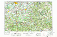
The Ohio River forms the central spine of this landscape, carving a meandering border between Indiana and Kentucky during a period of significant regional growth. Major river ports like Evansville, Owensboro, and Henderson serve as industrial and transit hubs, connected by a dense network of iron and asphalt. The rail-to-road transition is evident as the Illinois Central RR and Louisville and Nashville RR operate alongside newly established routes like the Pennyrile Parkway.
Find a feature on this map
67 named features on this map. Tap any name to fly to it.
Don’t see what you’re looking for? This feature index may not catch every label — zoom into the map to look around manually.
Map Details
Editions of this 1957 Evansville Map
3 editions found
Other maps of this area

1900 · St Meinrad
USGS Topo · 1:62,500

1900 · De Gonia Springs
USGS Topo · 1:62,500

1901 · Owensboro
USGS Topo · 1:62,500

1901 · Haubstadt
USGS Topo · 1:62,500

1902 · Ditney
USGS Topo · 1:125,000

1902 · Degonia Springs
USGS Topo · 1:62,500

1902 · Boonville
USGS Topo · 1:62,500

1903 · St. Meinrad
USGS Topo · 1:62,500

1903 · Haubstadt
USGS Topo · 1:62,500

1903 · New Harmony
USGS Topo · 1:62,500