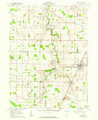
1961 Map of Forest
USGS Topo · Published 1962About this map
The Blanchard River and its meandering tributaries, including Potato Run and Ripley Run, define the rural landscape of this Hardin County area in the early 1960s. The village of Forest serves as a central hub, where the crossing of the Pennsylvania and New York Central railroads once drove the local economy. Evidence of the region’s agricultural and extractive history is scattered across the township lines, including numerous Gas Wells, an Oil Well, and a Quarry near the small settlement of McVitty.
Find a feature on this map
31 named features on this map. Tap any name to fly to it.
Don’t see what you’re looking for? This feature index may not catch every label — zoom into the map to look around manually.
Map Details
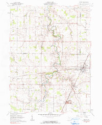
Editions of this 1961 Forest Map
2 editions found
Other maps of this area

1905 · Arlington
USGS Topo · 1:62,500

1907 · Arlington
USGS Topo · 1:24,000

1907 · Upper Sandusky
USGS Topo · 1:62,500

1915 · Kenton
USGS Topo · 1:62,500

1915 · La Rue
USGS Topo · 1:62,500

1944 · Kenton
USGS Topo · 1:62,500

1950 · Marion
USGS Topo · 1:250,000

1960 · Arlington
USGS Topo · 1:24,000

1960 · Mt Blanchard
USGS Topo · 1:24,000

1960 · Marseilles
USGS Topo · 1:24,000