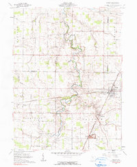
1961 Map of Forest
USGS Topo · Published 1990About this map
The village of Forest serves as a central junction where the Pennsylvania and New York Central railroads intersect, highlighting the region's importance as a transportation corridor in the early 1960s. This agricultural landscape in Hardin County is deeply marked by the meandering Blanchard River and several small tributaries like Potato Run and Ripley Run. The map provides significant detail for genealogists, documenting numerous family-named burial grounds such as Earlywine Cem, Adams Cem, and Johnson Cem. Rural life is further anchored by community landmarks including Mt Zion Ch and Union Chapel. To the south, the presence of several Gas Wells and a Quarry near McVitty points to a localized extraction economy operating alongside the established rail-side settlements of Patterson and Forest.
Find a feature on this map
33 named features on this map. Tap any name to fly to it.
Don’t see what you’re looking for? This feature index may not catch every label — zoom into the map to look around manually.
Map Details
Editions of this 1961 Forest Map
2 editions found
Other maps of this area

1905 · Arlington
USGS Topo · 1:62,500

1907 · Arlington
USGS Topo · 1:24,000

1907 · Upper Sandusky
USGS Topo · 1:62,500

1915 · Kenton
USGS Topo · 1:62,500

1915 · La Rue
USGS Topo · 1:62,500

1944 · Kenton
USGS Topo · 1:62,500

1950 · Marion
USGS Topo · 1:250,000

1960 · Arlington
USGS Topo · 1:24,000

1960 · Mt Blanchard
USGS Topo · 1:24,000

1960 · Marseilles
USGS Topo · 1:24,000