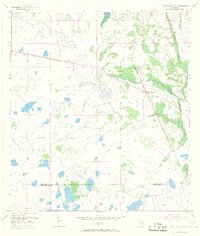
1953 Map of Fort Drum NW
USGS Topo · Published 1968About this map
Yeehaw Junction serves as the primary crossroads in this landscape, situated at the intersection of several developing state routes in the early 1950s. The surrounding terrain is defined by an intricate network of wetlands and seasonal water bodies, including Blue Cypress Creek and Wolf Hammock. This survey, compiled from 1950 aerial photography and later plane-table work, documents a remote interior of Florida before large-scale drainage projects significantly altered the regional hydrology. Evidence of early industrial and transit history is preserved through the Old Railroad Grade that cuts across the eastern portion of the sheet. The map also delineates the jurisdictional boundaries between Osceola, Indian River, and Okeechobee counties, providing a clear record of land division in this sparsely populated cattle and timber region.
Find a feature on this map
7 named features on this map. Tap any name to fly to it.
Don’t see what you’re looking for? This feature index may not catch every label — zoom into the map to look around manually.
Map Details
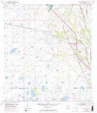
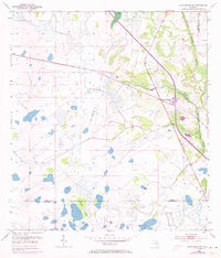
Editions of this 1953 Fort Drum NW Map
4 editions found
Other maps of this area

1953 · Fort Drum
USGS Topo · 1:24,000

1953 · Fort Kissimmee NE
USGS Topo · 1:24,000

1953 · Fort Drum SW
USGS Topo · 1:24,000

1953 · Lake Marian SE
USGS Topo · 1:24,000

1953 · Fort Drum NW
USGS Topo · 1:24,000

1953 · Kenansville SW
USGS Topo · 1:24,000

1953 · Fort Drum NE
USGS Topo · 1:24,000

1953 · Kenansville SE
USGS Topo · 1:24,000

1953 · Fort Kissimmee SE
USGS Topo · 1:24,000

1956 · Fort Pierce
USGS Topo · 1:250,000