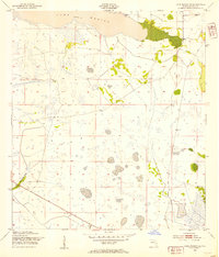
1952 Map of Fort Kissimmee NW
USGS Topo · Published 1967About this map
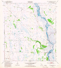
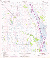
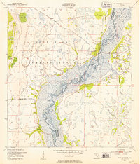
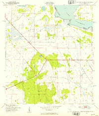
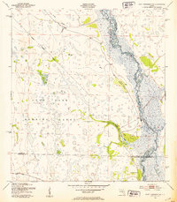
The Kissimmee River meanders through a complex network of wetlands and hammocks in this early 1950s survey of the Florida interior. A significant portion of the western terrain is occupied by the Avon Park Bombing Range, its Bombing Range Boundary cutting diagonally across a landscape defined by seasonal water flow and scattered hardwood islands. These islands, known locally as hammocks, appear with descriptive names like Rattlesnake Hammock, Hard Luck Hammock, and Orange Hammock, providing dry ground amidst the expansive marsh system. The intricate drainage of the region is evident in the numerous waterways feeding the river, including the curiously named Ice Cream Slough, as well as Eightmile Slough and Tick Island Slough. This map documents the natural hydrology of the area before modern water management projects significantly altered the river's course, preserving a view of the original wetland mosaic at the intersection of Polk, Osceola, Highlands, and Okeechobee counties.
Find a feature on this map
16 named features on this map. Tap any name to fly to it.
Don’t see what you’re looking for? This feature index may not catch every label — zoom into the map to look around manually.
Map Details
Editions of this 1952 Fort Kissimmee NW Map
3 editions found
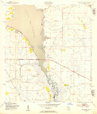
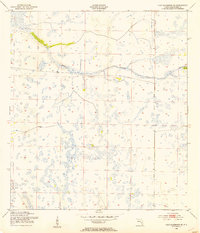
Other maps of this area
1952 · Fort Kissimmee
USGS Topo · 1:24,000
1952 · Lake Weohyakapka SE
USGS Topo · 1:24,000
1952 · Fort Kissimmee NW
USGS Topo · 1:24,000
1952 · Lake Arbuckle NE
USGS Topo · 1:24,000
1952 · Lake Arbuckle SE
USGS Topo · 1:24,000
1953 · Fort Kissimmee NE
USGS Topo · 1:24,000
1953 · Lake Marian SE
USGS Topo · 1:24,000
1953 · Lake Marian SW
USGS Topo · 1:24,000
1953 · Fort Kissimmee SE
USGS Topo · 1:24,000

1956 · Fort Pierce
USGS Topo · 1:250,000