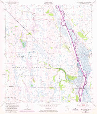
1952 Map of Fort Kissimmee NW
USGS Topo · Published 1973About this map
Avon Park Bombing Range occupies a massive portion of this interior Florida landscape, its western boundary cutting a straight diagonal across a mosaic of wetlands and hammocks. The Kissimmee River meanders heavily along the eastern edge of the map, showing the complex oxbows and marshy margins that existed before later channelization efforts. Isolated clusters of higher ground, or hammocks, are scattered throughout the marshy terrain, often bearing evocative names like Hard Luck Hammock, Orange Hammock, and Rattlesnake Hammock. Water movement across this low-lying region is defined by slow-moving features such as Ice Cream Slough and Tick Island Slough. This survey captures the area at a mid-century crossroads, where military land use met a traditional landscape of cypress strands and wet prairies at the junction of Polk, Osceola, and Highlands counties.
Find a feature on this map
14 named features on this map. Tap any name to fly to it.
Don’t see what you’re looking for? This feature index may not catch every label — zoom into the map to look around manually.
Map Details
Editions of this 1952 Fort Kissimmee NW Map
3 editions found
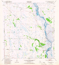
Other maps of this area

1952 · Fort Kissimmee
USGS Topo · 1:24,000

1952 · Lake Weohyakapka SE
USGS Topo · 1:24,000

1952 · Fort Kissimmee NW
USGS Topo · 1:24,000

1952 · Lake Arbuckle NE
USGS Topo · 1:24,000

1952 · Lake Arbuckle SE
USGS Topo · 1:24,000

1953 · Fort Kissimmee NE
USGS Topo · 1:24,000

1953 · Lake Marian SE
USGS Topo · 1:24,000

1953 · Lake Marian SW
USGS Topo · 1:24,000

1953 · Fort Kissimmee SE
USGS Topo · 1:24,000

1956 · Fort Pierce
USGS Topo · 1:250,000