
1899 Map of Fortymile
USGS Topo · Published 1902About this map
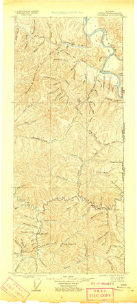
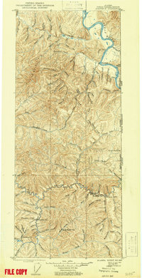
Eagle City and the winding Yukon River dominate this early gold-rush era survey of the Alaska-Canada borderlands. Recorded just after the Klondike peak, the map captures the frontier settlements of Star City and Seventymile at a time when river transport and prospecting dictated the region's layout. The terrain is defined by the high peaks of Glacier Mountain and Fortymile Dome, with a dense network of gold-bearing waterways such as American Creek, Seventymile Creek, and Mission Creek branching through the interior.
Find a feature on this map
85 named features on this map. Tap any name to fly to it.
Don’t see what you’re looking for? This feature index may not catch every label — zoom into the map to look around manually.
Map Details
Editions of this 1899 Fortymile Map
3 editions found
Other maps of this area

1949 · Tanacross
USGS Topo · 1:250,000

1950 · Tanacross
USGS Topo · 1:250,000

1951 · Charley River
USGS Topo · 1:250,000

1951 · Eagle
USGS Topo · 1:250,000

1956 · Charley River A-3
USGS Topo · 1:63,360

1956 · Charley River A-2
USGS Topo · 1:63,360

1956 · Charley River A-1
USGS Topo · 1:63,360

1956 · Charley River
USGS Topo · 1:250,000

1956 · Tanacross D-3
USGS Topo · 1:63,360

1956 · Tanacross D-2
USGS Topo · 1:63,360