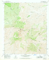
1964 Map of Four Peaks
USGS Topo · Published 1969About this map
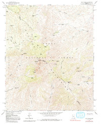
Mazatzal Mountains terrain dominates this mid-1960s survey, defined by the iconic silhouette of the Four Peaks. The ridge line serves as the boundary between Gila and Maricopa counties, reaching its highest elevation at Browns Peak. The landscape is a network of springs and specialized trails, including the Lone Pine Trail and Soldier Camp Trail, reflecting a history of livestock grazing and early forest management within the Tonto National Forest. Small-scale historical activity is evidenced by isolated structures like the Three Bar Cabin and Browns Cabin Spring, alongside various Mine and Prospect locations. This specific period shows the area primarily as a primitive wilderness before modern recreational infrastructure expanded, with access limited to routes like El Oso Road and the Pigeon Spring Road.
Find a feature on this map
63 named features on this map. Tap any name to fly to it.
Don’t see what you’re looking for? This feature index may not catch every label — zoom into the map to look around manually.
Map Details
Editions of this 1964 Four Peaks Map
5 editions found
Other maps of this area

1907 · Roosevelt
USGS Topo · 1:125,000

1909 · Four Peaks
USGS Topo · 1:125,000

1912 · Roosevelt
USGS Topo · 1:125,000

1954 · Mesa
USGS Topo · 1:250,000

1957 · Mesa
USGS Topo · 1:250,000

1958 · Mesa
USGS Topo · 1:250,000

1960 · Mesa
USGS Topo · 1:250,000
1963 · Mine Mountain
USGS Topo · 1:24,000

1964 · Mesa
USGS Topo · 1:250,000
1964 · Greenback Creek
USGS Topo · 1:24,000