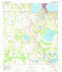
1953 Map of Frostproof
USGS Topo · Published 1973About this map
The town of Frostproof serves as the focal point for this landscape in the early 1950s, bordered by the expansive waters of Lake Clinch and Reedy Lake. The geography is defined by a dense concentration of citrus groves and water bodies, illustrating the region's agricultural and hydrologic character before modern expansion. Transportation infrastructure, including the Seaboard Coast Line and an Old Railroad Grade, connects smaller outposts like West Frostproof and Maxey Quarters to the larger rail network. To the south, the terrain becomes increasingly dotted with small lakes such as Saddle Blanket Lakes and Lake Streety, while the Polk and Highlands County line marks a transition toward Avon Park Lakes. Researchers can locate community landmarks including the Silver Lake Cem and Corinth Ch, which provide specific points of interest for genealogical study and local history.
Find a feature on this map
32 named features on this map. Tap any name to fly to it.
Don’t see what you’re looking for? This feature index may not catch every label — zoom into the map to look around manually.
Map Details
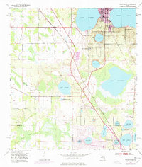
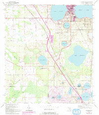
Editions of this 1953 Frostproof Map
5 editions found

Other maps of this area

1952 · Lake Arbuckle SW
USGS Topo · 1:24,000

1952 · Babson Park
USGS Topo · 1:24,000

1952 · Lake Arbuckle
USGS Topo · 1:24,000

1952 · Lake Weohyakapka
USGS Topo · 1:24,000

1953 · Frostproof
USGS Topo · 1:24,000

1953 · Avon Park
USGS Topo · 1:24,000

1955 · Alturas
USGS Topo · 1:24,000

1956 · Bereah
USGS Topo · 1:24,000

1956 · Griffins Corner
USGS Topo · 1:24,000

1956 · Fort Pierce
USGS Topo · 1:250,000