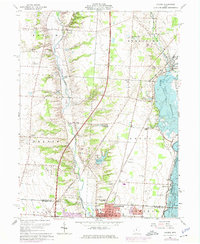
1964 Map of Galena
USGS Topo · Published 1975About this map
The Alum Creek valley is captured here during a period of massive hydrological transition, dominated by the construction of Alum Creek Lake. While the older flow of the creek remains visible, the Dam Under Construction signals the imminent drowning of the surrounding bottomlands. To the east, the established Hoover Reservoir and the Westerville Reservoir provide a contrast in water management. The settlement of Westerville anchors the southern edge of the map, featuring the grounds of Otterbein College and several local landmarks like St Pauls Sch. Scattered rural history is preserved in the naming of small communities such as Africa and Mackstown, along with numerous family and community burial grounds including McNamara Cem, Peachblow Cem, and Africa Cem. The Penn Central rail line cuts through the eastern half of the sheet, connecting Galena to the growing suburbs of Columbus.
Find a feature on this map
52 named features on this map. Tap any name to fly to it.
Don’t see what you’re looking for? This feature index may not catch every label — zoom into the map to look around manually.
Map Details
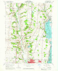
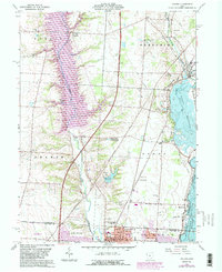
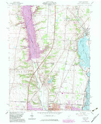
Editions of this 1964 Galena Map
4 editions found
Other maps of this area

1901 · Dublin
USGS Topo · 1:62,500

1902 · Westerville
USGS Topo · 1:62,500

1903 · Dublin
USGS Topo · 1:62,500

1904 · Westerville
USGS Topo · 1:62,500

1915 · Marengo
USGS Topo · 1:62,500

1924 · Delaware
USGS Topo · 1:62,500

1925 · Delaware
USGS Topo · 1:62,500

1943 · Marengo
USGS Topo · 1:62,500

1944 · Delaware
USGS Topo · 1:62,500

1950 · Marion
USGS Topo · 1:250,000