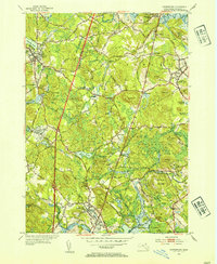
1953 Map of Georgetown
USGS Topo · Published 1954About this map
The Newburyport Turnpike cuts a straight path through the North Shore landscape, connecting historic villages and institutional landmarks during the mid-century. To the north, the prestigious Dummer Academy stands near South Byfield, while the Adelynrood Retreat occupies a quiet position near the Parker River. The area's agricultural and industrial heritage is evident in the transition from the Glen Mills area to the wooded expanses of the Georgetown Rowley State Forest and Willowdale State Forest.
Find a feature on this map
78 named features on this map. Tap any name to fly to it.
Don’t see what you’re looking for? This feature index may not catch every label — zoom into the map to look around manually.
Map Details
Editions of this 1953 Georgetown Map
4 editions found
Other maps of this area

1886 · Lawrence
USGS Topo · 1:62,500

1888 · Newburyport
USGS Topo · 1:62,500

1888 · Haverhill
USGS Topo · 1:62,500

1888 · Lawrence
USGS Topo · 1:62,500

1888 · Salem
USGS Topo · 1:62,500

1890 · Haverhill
USGS Topo · 1:62,500

1890 · Newburyport
USGS Topo · 1:62,500

1893 · Salem
USGS Topo · 1:62,500

1893 · Lawrence
USGS Topo · 1:62,500

1893 · Haverhill
USGS Topo · 1:62,500