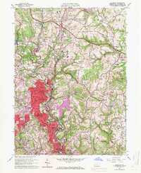
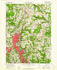
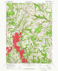
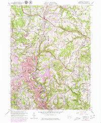
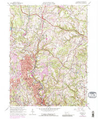
1960 Map of Glenshaw
USGS Topo · Published 1971About this map
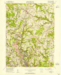
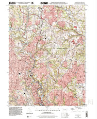
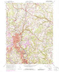
The suburban expansion of northern Allegheny County is underway on this 1960s revision, where industrial corridors and residential clusters sit alongside established landmarks like the Radio Sta (KDKA) tower near Allison Park. The landscape is dominated by the winding path of Pine Creek, which dictates the route of the Baltimore and Ohio Railroad as it passes through Glenshaw and Etna. Significant residential and institutional density is evident in the southern half of the quadrangle, where many neighborhood schools and sectarian cemeteries, such as Mt Royal Cemetery and Beth Shalom Cemetery, serve the growing population.
Find a feature on this map
98 named features on this map. Tap any name to fly to it.
Don’t see what you’re looking for? This feature index may not catch every label — zoom into the map to look around manually.
Map Details
Editions of this 1960 Glenshaw Map
6 editions found
Historical Maps of Ross Township Through Time
8 maps found