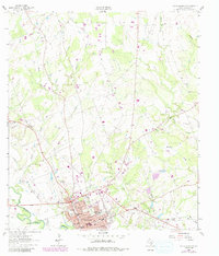
1962 Map of Gonzales North
USGS Topo · Published 1991About this map
The confluence of the San Marcos River and the Guadalupe River anchoring the southern edge of this survey defines the historic character of Gonzales. As the 1960s began, the town displayed a dense network of local institutions, from the Edwards High Sch and North Ave Sch to the expansive grounds of Gonzales Memorial Park. The landscape north of the city is etched by several prominent drainage systems including North Fork Smith Creek and Denton Creek, with rural life marked by the Clark Ch and a series of family and fraternal burial grounds such as the Odd Fellow Cem and Masonic Cem.
Find a feature on this map
32 named features on this map. Tap any name to fly to it.
Don’t see what you’re looking for? This feature index may not catch every label — zoom into the map to look around manually.
Map Details
Editions of this 1962 Gonzales North Map
Other maps of this area

1901 · Flatonia
USGS Topo · 1:125,000

1911 · San Marcos
USGS Topo · 1:125,000

1919 · San Marcos
USGS Topo · 1:125,000

1920 · Smiley
USGS Topo · 1:125,000

1925 · San Marcos 4-a
USGS Topo · 1:48,000

1929 · Luling
USGS Topo · 1:62,500

1953 · Seguin
USGS Topo · 1:250,000

1958 · Seguin
USGS Topo · 1:250,000

1959 · Ottine
USGS Topo · 1:24,000

1959 · Cost
USGS Topo · 1:24,000