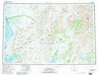
1979 Map of Goodnews Bay
USGS Topo · Published 1979About this map
The Kanektok River and Goodnews River define the intricate drainage systems of this southwestern Alaska landscape, captured in a period of significant conservation designations during the late 1970s. The map illustrates the coastal settlements of Quinhagak on Kuskokwim Bay and the village of Goodnews Bay, which sits at the base of the Ahklun Mountains. These communities are shown amidst a vast network of glacial lakes and mountain ridges, where water serves as the primary corridor for movement, supplemented by a documented Winter Trail leading north from the coast.
Find a feature on this map
108 named features on this map. Tap any name to fly to it.
Don’t see what you’re looking for? This feature index may not catch every label — zoom into the map to look around manually.
Map Details
Editions of this 1979 Goodnews Bay Map
2 editions found

Other maps of this area

1945 · Nushagak Bay
USGS Topo · 1:250,000

1947 · Hagemeister Island D-2
USGS Topo · 1:63,360

1948 · Hagemeister Island D-3
USGS Topo · 1:63,360

1948 · Nushagak Bay D-4
USGS Topo · 1:63,360

1948 · Nushagak Bay D-3
USGS Topo · 1:63,360

1949 · Nushagak Bay
USGS Topo · 1:250,000

1950 · Bethel
USGS Topo · 1:250,000

1950 · Nushagak Bay D-5
USGS Topo · 1:63,360

1950 · Nushagak Bay D-6
USGS Topo · 1:63,360

1950 · Hagemeister Island D-6
USGS Topo · 1:63,360