
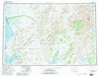
1979 Map of Goodnews Bay
USGS Topo · Published 1979About this map
Quinhagak and Platinum anchor the coastal reaches of this southwestern Alaska landscape, where the Kanektok River and Goodnews River drain into the cold waters of Kuskokwim Bay. The terrain is dominated by the massive Ahklun Mountains and Kilbuck Mountains, a wilderness of peaks like Mount Oratia and Mt Waskey. This late-1970s record illustrates the immense scale of protected lands including the Togiak National Wildlife Refuge and the eastern edge of Wood-Tikchik State Park. A network of winter trails and waterways connects remote outposts, while prominent landmarks like Cape Newenham and Island Butte serve as essential navigational markers. The map captures the region's character as a crossroads of river systems, showing the complex drainage of the Togiak River and its numerous glacial lakes, such as Kashaiak Lake and Pungokepuk Lake.
Find a feature on this map
69 named features on this map. Tap any name to fly to it.
Don’t see what you’re looking for? This feature index may not catch every label — zoom into the map to look around manually.
Map Details
Editions of this 1979 Goodnews Bay Map
2 editions found
Other maps of this area

1945 · Nushagak Bay
USGS Topo · 1:250,000

1947 · Hagemeister Island D-2
USGS Topo · 1:63,360

1948 · Hagemeister Island D-3
USGS Topo · 1:63,360

1948 · Nushagak Bay D-4
USGS Topo · 1:63,360

1948 · Nushagak Bay D-3
USGS Topo · 1:63,360

1949 · Nushagak Bay
USGS Topo · 1:250,000

1950 · Bethel
USGS Topo · 1:250,000

1950 · Nushagak Bay D-5
USGS Topo · 1:63,360

1950 · Nushagak Bay D-6
USGS Topo · 1:63,360

1950 · Hagemeister Island D-6
USGS Topo · 1:63,360