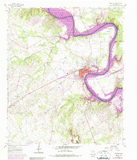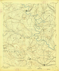
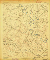
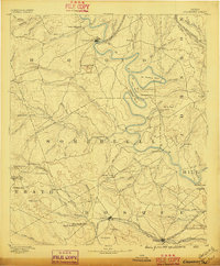
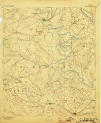
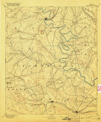
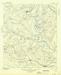
1889 Map of Granbury
USGS Topo · Published 1925About this map
The winding Brazos River carves a dramatic path through Central Texas in this late 19th-century survey, defining the boundaries between Hood, Somervell, and Johnson counties. The landscape is dominated by riverine loops like De Cordova Bend and Abby Bend, where early frontier settlements such as Fort Spunky and Brazos Point once served as vital crossings and landmarks. The terrain transitions from these alluvial bends into the high elevations of Comanche Peak and the Powelldale Mountains, marking a rugged limestone geography that historically dictated the path of overland travel.
Find a feature on this map
88 named features on this map. Tap any name to fly to it.
Don’t see what you’re looking for? This feature index may not catch every label — zoom into the map to look around manually.
Map Details
Editions of this 1889 Granbury Map
6 editions found
Historical Maps of Cleburne Through Time
7 maps found