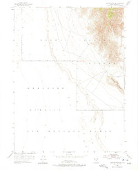
1954 Map of Granite Peak SE
USGS Topo · Published 1975About this map
The vast, arid expanse of Tooele County is defined by its transition from high desert terrain to restricted military zones in this mid-century survey. The prominent Sapphire Mountain stands as a focal landmark in the eastern portion of the sheet, providing a stark topographical contrast to the surrounding flats. Much of the landscape is dominated by the overlapping boundaries of the Dugway Proving Ground and the Wendover Bombing and Gunnery Range, reflecting the area's critical role in Cold War-era defense operations. This map serves as a precise record of the road networks and township lines, including the junction of T. 8 S. and T. 9 S. and R. 14 W. and R. 13 W., which guided the management of these remote military installations.
Find a feature on this map
7 named features on this map. Tap any name to fly to it.
Don’t see what you’re looking for? This feature index may not catch every label — zoom into the map to look around manually.
Map Details
Editions of this 1954 Granite Peak SE Map
4 editions found
Other maps of this area

1908 · Fish Springs
USGS Topo · 1:250,000

1910 · Fish Springs
USGS Topo · 1:250,000

1953 · Dugway Range
USGS Topo · 1:62,500

1953 · Dugway Range NW
USGS Topo · 1:24,000

1953 · Tooele
USGS Topo · 1:250,000

1953 · Delta
USGS Topo · 1:250,000

1954 · Granite Peak
USGS Topo · 1:24,000

1954 · Dugway Proving Ground SW
USGS Topo · 1:24,000

1954 · Dugway Proving Ground NW
USGS Topo · 1:24,000

1954 · Granite Peak SE
USGS Topo · 1:24,000