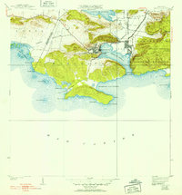
1938 Map of Guanica
USGS Topo · Published 1952About this map
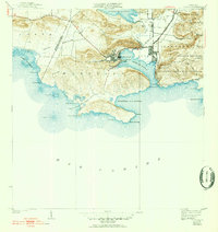
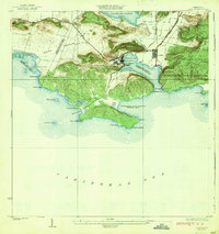
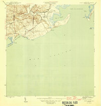
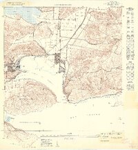
The industrial sugar economy of southern Puerto Rico is centered here on Central Guanica, one of the island's most significant sugar mills, connected by a network of rail lines simply marked as Central and Linea. This landscape in the late 1930s shows the dense core of Pueblo and Ensenada at the head of the deep-water Bahia de Guanica. Beyond the industrial activity, the map records local life through the Escuela Ceiba and several sites marked Cem. The terrain transitions from the marshy Laguna de Guanica and the Rio Loco in the north to the protected Bosque Insular de Guanica Yauco y Guayanilla on the eastern hills. Maritime landmarks such as the Fard de Guanica lighthouse and the jagged coastline of Frontón de la Brea define the southern edge where the land meets the Mar Caribe.
Find a feature on this map
46 named features on this map. Tap any name to fly to it.
Don’t see what you’re looking for? This feature index may not catch every label — zoom into the map to look around manually.
Map Details
Editions of this 1938 Guanica Map
6 editions found
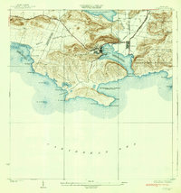
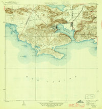
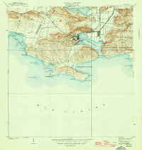
Other maps of this area

1937 · San German
USGS Topo · 1:25,000

1937 · Sabana Grande
USGS Topo · 1:25,000
1938 · Guanica
USGS Topo · 1:30,000

1938 · Parguera
USGS Topo · 1:30,000

1941 · San German
USGS Topo · 1:30,000

1941 · Sabana Grande
USGS Topo · 1:30,000

1946 · Yauco
USGS Topo · 1:30,000
1946 · Punta Verraco
USGS Topo · 1:30,000

1947 · Yauco SO
USGS Topo · 1:10,000
1949 · Guanica NE
USGS Topo · 1:10,000