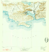
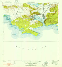
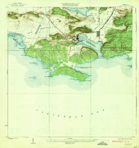
1938 Map of Guanica
USGS Topo · Published 1952About this map
Central Guánica stands as a massive industrial anchor along the northern edge of the Bahia de Guanica, reflecting the dominant role of the sugar industry during the mid-20th century. The surrounding landscape is defined by the Linea rail infrastructure and the neighboring residential core of Pueblo and Ensenada. This era shows a coastal environment transitioning between intense agriculture and maritime navigation, evidenced by the Faro de Guánica overlooking the Caribbean entrance and the broad Laguna de Guanica to the north.
Find a feature on this map
51 named features on this map. Tap any name to fly to it.
Don’t see what you’re looking for? This feature index may not catch every label — zoom into the map to look around manually.
Map Details
Editions of this 1938 Guanica Map
6 editions found
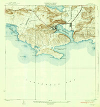
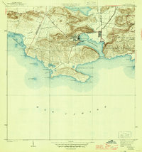
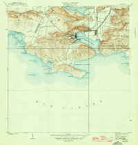
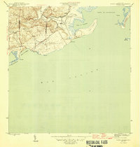
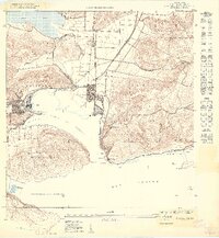
Other maps of this area

1937 · San German
USGS Topo · 1:25,000

1937 · Sabana Grande
USGS Topo · 1:25,000
1938 · Guanica
USGS Topo · 1:30,000

1938 · Parguera
USGS Topo · 1:30,000

1941 · San German
USGS Topo · 1:30,000

1941 · Sabana Grande
USGS Topo · 1:30,000

1946 · Yauco
USGS Topo · 1:30,000
1946 · Punta Verraco
USGS Topo · 1:30,000

1947 · Yauco SO
USGS Topo · 1:10,000
1949 · Guanica NE
USGS Topo · 1:10,000