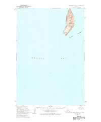
1948 Map of Hagemeister Island C-2
USGS Topo · Published 1984About this map
High Island rises sharply from the waters of Bristol Bay, serving as the primary landform in this isolated maritime survey. Part of the broader Walrus Islands chain, the island is characterized by its steep, elevated interior, marked by survey stations VABM High 1549 and Vabm 1655. These heights contrast with the narrow stretches of Sand Beach that line its western and eastern shores.
Find a feature on this map
7 named features on this map. Tap any name to fly to it.
Don’t see what you’re looking for? This feature index may not catch every label — zoom into the map to look around manually.
Map Details
Editions of this 1948 Hagemeister Island C-2 Map
2 editions found
Other maps of this area

1947 · Hagemeister Island D-2
USGS Topo · 1:63,360

1948 · Hagemeister Island D-3
USGS Topo · 1:63,360

1948 · Hagemeister Island C-3
USGS Topo · 1:63,360
1948 · Hagemeister Island C-2
USGS Topo · 1:63,360

1948 · Hagemeister Island C-1
USGS Topo · 1:63,360

1950 · Hagemeister Island D-1
USGS Topo · 1:63,360

1951 · Hagemeister Island
USGS Topo · 1:250,000

1952 · Hagemeister Island C-1
USGS Topo · 1:63,360

1952 · Hagemeister Island C-3
USGS Topo · 1:63,360

1952 · Hagemeister Island C-2
USGS Topo · 1:63,360