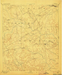
1894 Map of Hamilton
USGS Topo · Published 1906About this map
Central Texas ranching and agricultural lands appear in fine detail in this 1886 survey, centered on the emerging county seat of Hamilton. The landscape is defined by the drainage basins of the Leon River and the Lampasas River, where small rural communities like Gentry Mill and Hazle Dell serve as local hubs for the surrounding farmsteads. To the north, the Texas Central Railroad cuts across the corner of the map near the Bosque River, providing a vital connection to outside markets during the late nineteenth-century cattle and cotton boom.
Find a feature on this map
47 named features on this map. Tap any name to fly to it.
Don’t see what you’re looking for? This feature index may not catch every label — zoom into the map to look around manually.
Map Details
Editions of this 1894 Hamilton Map
5 editions found
Other maps of this area

1885 · San Saba
USGS Topo · 1:125,000

1887 · Lampasas
USGS Topo · 1:125,000

1888 · Hamilton
USGS Topo · 1:125,000

1888 · Meridian
USGS Topo · 1:125,000

1889 · Granbury
USGS Topo · 1:125,000

1889 · Brownwood
USGS Topo · 1:125,000

1890 · Stephenville
USGS Topo · 1:125,000

1894 · Hamilton
USGS Topo · 1:125,000

1894 · Meridian
USGS Topo · 1:125,000

1894 · Lampasas
USGS Topo · 1:125,000