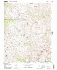
1955 Map of Handies Peak
USGS Topo · Published 1991About this map
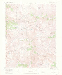
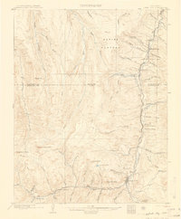
The high mountain basins of the San Juan Mountains are documented here during a period of transition in the mid-1950s. Mining infrastructure from previous decades remains prominent, though several significant settlements are identified as abandoned. The landscape is dominated by the upper reaches of the Animas River and its various forks, with the townsite of Eureka situated near the junction of the South Fork Animas River. Further north, Animas Forks sits at a high-elevation crossroads leading toward Engineer Pass and Cinnamon Pass.
Find a feature on this map
78 named features on this map. Tap any name to fly to it.
Don’t see what you’re looking for? This feature index may not catch every label — zoom into the map to look around manually.
Map Details
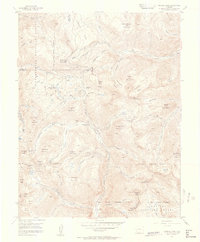
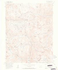
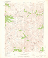
Editions of this 1955 Handies Peak Map
7 editions found
Other maps of this area

1897 · Silverton
USGS Topo · 1:62,500

1901 · Silverton
USGS Topo · 1:62,500

1902 · Silverton
USGS Topo · 1:62,500

1902 · Ouray
USGS Topo · 1:62,500
1903 · Lake City
USGS Topo · 1:62,500

1904 · Ouray
USGS Topo · 1:62,500
1905 · Lake City
USGS Topo · 1:62,500

1905 · San Cristobal
USGS Topo · 1:125,000

1907 · San Cristobal
USGS Topo · 1:125,000

1908 · Uncompahgre
USGS Topo · 1:125,000