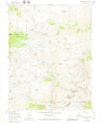
1955 Map of Handies Peak
USGS Topo · Published 1980About this map
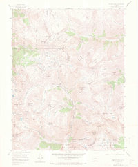
The high-altitude mining landscape of the San Juan Mountains is captured here during a 1955 field check, showing the late-stage footprint of legendary Colorado silver and gold districts. Settlements that once bustled with activity, including Animas Forks (Aband) and Mineral Point (Aband), are noted as abandoned, their street grids giving way to alpine trails. The sheer concentration of industrial remnants is evident through the labeling of the Sunnyside Mine, Old Lout Mine, and Treasure Mtn Mine. High mountain crossings like Engineer Pass and Cinnamon Pass serve as the primary conduits through the terrain, connecting deep glacial valleys such as California Gulch and American Basin. The map also details the headwaters of the Animas River near the site of Eureka (Aband), providing a meticulous record of the relationship between 19th-century resource extraction and the formidable topography of the San Juan National Forest.
Find a feature on this map
81 named features on this map. Tap any name to fly to it.
Don’t see what you’re looking for? This feature index may not catch every label — zoom into the map to look around manually.
Map Details
Editions of this 1955 Handies Peak Map
7 editions found
Other maps of this area

1897 · Silverton
USGS Topo · 1:62,500

1901 · Silverton
USGS Topo · 1:62,500

1902 · Silverton
USGS Topo · 1:62,500

1902 · Ouray
USGS Topo · 1:62,500

1903 · Lake City
USGS Topo · 1:62,500

1904 · Ouray
USGS Topo · 1:62,500

1905 · Lake City
USGS Topo · 1:62,500

1905 · San Cristobal
USGS Topo · 1:125,000

1907 · San Cristobal
USGS Topo · 1:125,000

1908 · Uncompahgre
USGS Topo · 1:125,000