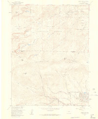
1957 Map of Harris Park
USGS Topo · Published 1959About this map
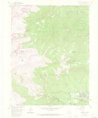
Harris Park and Highland Park sit at the eastern base of the Front Range, where the drainages of Elk Creek and Deer Creek begin their descent toward the plains. This mid-century survey captures a landscape of managed wildlands and early mountain residential clusters, divided between the Arapaho National Forest to the north and the Pike National Forest to the south. The transition from high peaks like Rosalie Peak and Rogers Peak down to the sheltered valley at Royal Ranch highlights the area's role as a recreational and conservation corridor. High-altitude landmarks such as the Mt. Evans Shelter House and various campgrounds like Camp Rock Campground and Camp Rosalie illustrate the developed accessibility of these peaks during the 1950s. Geologic features like the prominent Pegmatite Points and numerous glacial basins containing the Beartrack Lakes and Lincoln Lake dominate the high western terrain.
Find a feature on this map
32 named features on this map. Tap any name to fly to it.
Don’t see what you’re looking for? This feature index may not catch every label — zoom into the map to look around manually.
Map Details
Editions of this 1957 Harris Park Map
8 editions found
Other maps of this area

1893 · Platte Canyon
USGS Topo · 1:125,000

1899 · West Denver
USGS Topo · 1:125,000

1903 · Georgetown
USGS Topo · 1:62,500

1905 · Georgetown
USGS Topo · 1:62,500

1945 · Bailey
USGS Topo · 1:24,000

1945 · Shawnee
USGS Topo · 1:24,000

1945 · Mount Logan
USGS Topo · 1:24,000

1948 · Mount Logan
USGS Topo · 1:24,000

1948 · Shawnee
USGS Topo · 1:24,000

1949 · Bailey
USGS Topo · 1:24,000