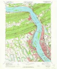
1969 Map of Harrisburg West
USGS Topo · Published 1972About this map
The Susquehanna River dominates this landscape, serving as both a geographic barrier and a transport corridor between the ridges of the Appalachians. In the late 1960s, the river is spanned by several major crossings, including the massive Rockville Bridge and the M. Harvey Taylor Bridge, linking Harrisburg with the growing West Shore communities of Enola, Wormleysburg, and Camp Hill. The map illustrates the industrial and institutional character of the Pennsylvania capital, anchored by the State Capitol and the State Hospital.
Find a feature on this map
80 named features on this map. Tap any name to fly to it.
Don’t see what you’re looking for? This feature index may not catch every label — zoom into the map to look around manually.
Map Details
Editions of this 1969 Harrisburg West Map
4 editions found
Other maps of this area

1892 · Harrisburg
USGS Topo · 1:62,500

1899 · Harrisburg
USGS Topo · 1:62,500

1904 · Carlisle
USGS Topo · 1:62,500

1906 · New Cumberland
USGS Topo · 1:62,500

1907 · New Bloomfield
USGS Topo · 1:62,500

1924 · Harrisburg
USGS Topo · 1:62,500

1943 · New Cumberland
USGS Topo · 1:62,500

1943 · Harrisburg
USGS Topo · 1:62,500

1943 · New Bloomfield
USGS Topo · 1:62,500

1943 · Carlisle
USGS Topo · 1:62,500
Featured Places
- Harrisburg, PA
- Enola, East Pennsboro Township
- Wormleysburg, PA
- West Fairview, East Pennsboro Township
- Dauphin, PA