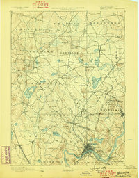
1893 Map of Haverhill
USGS Topo · Published 1898About this map
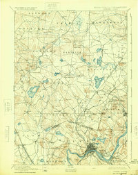
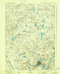
The Merrimac River serves as the industrial and geographical anchor of this late nineteenth-century borderland survey, with the dense street grids of Haverhill and Bradford clustered at its bend. The landscape is a complex network of New Hampshire and Massachusetts townships, defined by the era's heavy reliance on rail transport. Significant junctions and depots, such as Newton Junction and Atkinson Depot, illustrate how the Boston & Maine Railroad and its various branches, including the Merrimac Branch, dictated the growth of satellite settlements. Away from the river, the terrain is dotted with numerous glacial features, from the large Island Pond to the secluded Spruce Swamp. This period shows a well-established rural economy where small villages like Rock Village and Ayer Village maintained distinct identities before the expansion of modern suburban transit. Numerous family-named heights like Brandy Brow Hill and Philbrick Hill rise above the wetlands and winding streams like the Exeter River.
Find a feature on this map
102 named features on this map. Tap any name to fly to it.
Don’t see what you’re looking for? This feature index may not catch every label — zoom into the map to look around manually.
Map Details
Editions of this 1893 Haverhill Map
7 editions found

Other maps of this area

1886 · Lawrence
USGS Topo · 1:62,500

1886 · Lowell
USGS Topo · 1:62,500

1888 · Newburyport
USGS Topo · 1:62,500

1888 · Haverhill
USGS Topo · 1:62,500

1888 · Lawrence
USGS Topo · 1:62,500

1888 · Salem
USGS Topo · 1:62,500

1890 · Haverhill
USGS Topo · 1:62,500

1890 · Newburyport
USGS Topo · 1:62,500

1893 · Lowell
USGS Topo · 1:62,500

1893 · Dover
USGS Topo · 1:62,500