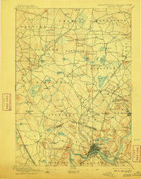
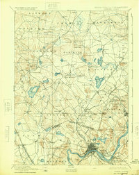
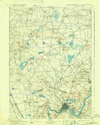
1893 Map of Haverhill
USGS Topo · Published 1910About this map
The Merrimac River anchors this 1893 survey of the borderlands between Massachusetts and New Hampshire, where the industrial center of Haverhill and the neighboring town of Bradford dominate the southern reach. The landscape is defined by a dense network of nineteenth-century transportation, including the Boston & Maine Railroad and the Manchester & Lawrence Railroad, which facilitated the growth of specialized rail-side settlements like Salem Depot and Atkinson Depot.
Find a feature on this map
105 named features on this map. Tap any name to fly to it.
Don’t see what you’re looking for? This feature index may not catch every label — zoom into the map to look around manually.
Map Details
Editions of this 1893 Haverhill Map
7 editions found

Other maps of this area

1886 · Lawrence
USGS Topo · 1:62,500

1886 · Lowell
USGS Topo · 1:62,500

1888 · Newburyport
USGS Topo · 1:62,500

1888 · Haverhill
USGS Topo · 1:62,500

1888 · Lawrence
USGS Topo · 1:62,500

1888 · Salem
USGS Topo · 1:62,500

1890 · Haverhill
USGS Topo · 1:62,500

1890 · Newburyport
USGS Topo · 1:62,500

1893 · Lowell
USGS Topo · 1:62,500

1893 · Dover
USGS Topo · 1:62,500