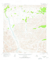
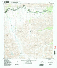
1953 Map of Healy C-5
USGS Topo · Published 1976About this map
Mt McKinley National Park is defined here by the drainage systems of the Savage River and Sanctuary River, which flow northward from the high peaks of the Alaska Range. This mid-century survey illustrates the early infrastructure of the park, specifically the McKinley Park Road as it winds across Primrose Ridge and past the Savage River Campground. The terrain is marked by prominent elevations such as Mt Wright, Double Mtn, and the distinctive Fang Mtn. To the south, the Refuge Valley provides a break in the high-relief landscape near the headwaters of Calico Creek. This map, based on 1949 and 1953 aerial photography, captures the primitive access routes and established camping sites at the Sanctuary River Campground before modern park expansions altered the character of these remote interior corridors.
Find a feature on this map
16 named features on this map. Tap any name to fly to it.
Don’t see what you’re looking for? This feature index may not catch every label — zoom into the map to look around manually.
Map Details
Editions of this 1953 Healy C-5 Map
6 editions found

Other maps of this area

1949 · Healy B-4
USGS Topo · 1:63,360

1950 · Healy D-4
USGS Topo · 1:63,360

1950 · Healy C-4
USGS Topo · 1:63,360

1950 · Healy B-5
USGS Topo · 1:63,360

1951 · Healy
USGS Topo · 1:250,000

1951 · Healy B-5
USGS Topo · 1:63,360

1951 · Healy B-4
USGS Topo · 1:63,360

1951 · Healy D-6
USGS Topo · 1:63,360

1951 · Healy D-5
USGS Topo · 1:63,360

1952 · Healy D-5
USGS Topo · 1:63,360