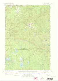
1955 Map of Herman
USGS Topo · Published 1976About this map
L'Anse Bay and the industrial activity of the mid-1950s Upper Peninsula characterize this survey of the Keweenaw Bay area. The landscape is dominated by the Baraga State Forest, where the Sturgeon River and its many tributaries, including Falls River and Plumbago Creek, carve through the timberland. Significant infrastructure includes the Duluth South Shore and Atlantic railroad, which supported local settlements like Herman, Alberta, and the junction at Nestoria.
Find a feature on this map
53 named features on this map. Tap any name to fly to it.
Don’t see what you’re looking for? This feature index may not catch every label — zoom into the map to look around manually.
Map Details
Editions of this 1955 Herman Map
3 editions found
Other maps of this area

1895 · Ned Lake
USGS Topo · 1:62,500

1895 · Perch Lake
USGS Topo · 1:62,500

1899 · Witbeck
USGS Topo · 1:62,500

1954 · Skanee
USGS Topo · 1:62,500

1954 · Keweenaw Bay
USGS Topo · 1:62,500

1954 · Perch Lake
USGS Topo · 1:62,500

1954 · Pelkie
USGS Topo · 1:62,500

1954 · Sidnaw
USGS Topo · 1:62,500

1955 · Ned Lake
USGS Topo · 1:62,500

1955 · Herman
USGS Topo · 1:62,500