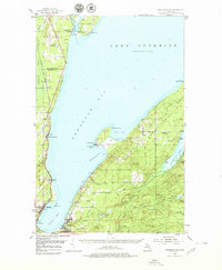
1954 Map of Keweenaw Bay
USGS Topo · Published 1979About this map
Keweenaw Bay defines this mid-century survey of the Upper Peninsula, where the shoreline is dotted with industrial and missionary history. At the southern head of the bay, the settlements of Baraga and L'Anse serve as primary hubs, while the Duluth South Shore and Atlantic railroad corridor traces the western coast through Assinins and Keweenaw Bay. The map captures the specialized geography of the Abbey Peninsula, featuring the small community of Aura with its Aura Cemetery and Aura School.
Find a feature on this map
49 named features on this map. Tap any name to fly to it.
Don’t see what you’re looking for? This feature index may not catch every label — zoom into the map to look around manually.
Map Details
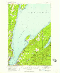
Editions of this 1954 Keweenaw Bay Map
3 editions found
Other maps of this area

1915 · Houghton
USGS Topo · 1:62,500

1946 · Chassell
USGS Topo · 1:24,000

1948 · Chassell
USGS Topo · 1:24,000

1954 · Traverse Island
USGS Topo · 1:24,000

1954 · Skanee
USGS Topo · 1:62,500

1954 · Keweenaw Bay
USGS Topo · 1:62,500

1954 · Point Mills
USGS Topo · 1:24,000

1954 · Pelkie
USGS Topo · 1:62,500

1954 · Sidnaw
USGS Topo · 1:62,500

1954 · Houghton
USGS Topo · 1:62,500