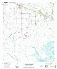
1964 Map of Hitchcock
USGS Topo · Published 1977About this map
Industrial and agricultural land-use patterns define this coastal region of Texas during the mid-1960s. The Atchison Topeka and Santa Fe railroad serves as a primary corridor, connecting the settlements of Alta Loma and Hitchcock as they expand toward La Marque. The landscape is a patchwork of family-named roads like Beine Road and McElmoyle Road, alongside significant energy infrastructure. The presence of the Alta Loma Oil Field, Franks Oil Field, and Sarah White Oil Field indicates the intense petroleum extraction defining the local economy.
Find a feature on this map
44 named features on this map. Tap any name to fly to it.
Don’t see what you’re looking for? This feature index may not catch every label — zoom into the map to look around manually.
Map Details
Editions of this 1964 Hitchcock Map
4 editions found
Other maps of this area

1929 · Dickinson
USGS Topo · 1:24,000

1929 · Karankawa Lake
USGS Topo · 1:24,000

1929 · Algoa
USGS Topo · 1:24,000

1929 · Hitchcock
USGS Topo · 1:24,000

1929 · Virginia Point
USGS Topo · 1:24,000

1929 · Texas City
USGS Topo · 1:24,000

1931 · Lake Como
USGS Topo · 1:24,000

1932 · Algoa
USGS Topo · 1:31,680

1932 · Dickinson
USGS Topo · 1:31,680

1932 · Texas City
USGS Topo · 1:31,680