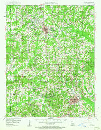
1952 Map of Homer
USGS Topo · Published 1963About this map
The Homer Oil Field dominates this mid-century portrait of Claiborne Parish, where industrial expansion and rural community life overlap. At the center of the local economy, the Louisiana and North West RR connects the major hubs of Homer and Haynesville, passing near extensive infrastructure including Oil Tanks and a Tank Farm. This era shows a landscape densely populated with small social centers, particularly churches and schools that served the surrounding agricultural and oil workers, such as the Rising Star Ch, Mt Lebanon Ch, and Mt Pisgah Sch & Cem. Natural drainage is defined by the Bayou D'Arbonne and its numerous tributaries like Tiger Creek and Lick Creek, which carve through the terrain toward the high point of Rocky Mountain. The presence of numerous family-named burial sites, such as the Gryder Cem and McKenzie Cem, provides a detailed record of the families who settled this region of North Louisiana.
Find a feature on this map
97 named features on this map. Tap any name to fly to it.
Don’t see what you’re looking for? This feature index may not catch every label — zoom into the map to look around manually.
Map Details
Editions of this 1952 Homer Map
4 editions found
Other maps of this area

1922 · Sarepta
USGS Topo · 1:62,500

1924 · Sarepta
USGS Topo · 1:62,500

1947 · Minden
USGS Topo · 1:62,500

1949 · Minden
USGS Topo · 1:62,500

1949 · Gibsland
USGS Topo · 1:62,500

1950 · Gibsland
USGS Topo · 1:62,500

1950 · Arcadia
USGS Topo · 1:62,500

1951 · Arcadia
USGS Topo · 1:62,500

1951 · Summerfield
USGS Topo · 1:62,500

1952 · Homer
USGS Topo · 1:62,500