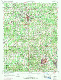
1952 Map of Homer
USGS Topo · Published 1969About this map
The Homer Oil Field dominates the central geography of this Claiborne Parish survey, illustrating the petroleum industry's footprint between the towns of Homer and Haynesville. Industrial infrastructure is everywhere apparent, from Oil Tanks and a Tank Farm near the railroad to the various wells scattered across the landscape. The Louisiana and North West RR provides the primary transit spine, connecting settlements like Millerton and Norton Corner.
Find a feature on this map
79 named features on this map. Tap any name to fly to it.
Don’t see what you’re looking for? This feature index may not catch every label — zoom into the map to look around manually.
Map Details
Editions of this 1952 Homer Map
4 editions found
Other maps of this area

1922 · Sarepta
USGS Topo · 1:62,500

1924 · Sarepta
USGS Topo · 1:62,500

1947 · Minden
USGS Topo · 1:62,500

1949 · Minden
USGS Topo · 1:62,500

1949 · Gibsland
USGS Topo · 1:62,500

1950 · Gibsland
USGS Topo · 1:62,500

1950 · Arcadia
USGS Topo · 1:62,500

1951 · Arcadia
USGS Topo · 1:62,500

1951 · Summerfield
USGS Topo · 1:62,500

1952 · Homer
USGS Topo · 1:62,500