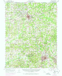
1952 Map of Homer
USGS Topo · Published 1977About this map
The Homer Oil Field dominates the central landscape of Claiborne Parish, reflecting a period of intense petroleum production with its dense network of oil tanks and a dedicated Tank Farm. The regional economy is anchored by the Homer and Haynesville settlements, connected by the Louisiana and North West RR. The map captures a transitional rural landscape where industry and community life intersect, visible in labels for the Oil Field School and Oil Field Church.
Find a feature on this map
90 named features on this map. Tap any name to fly to it.
Don’t see what you’re looking for? This feature index may not catch every label — zoom into the map to look around manually.
Map Details
Editions of this 1952 Homer Map
4 editions found
Other maps of this area

1922 · Sarepta
USGS Topo · 1:62,500

1924 · Sarepta
USGS Topo · 1:62,500

1947 · Minden
USGS Topo · 1:62,500

1949 · Minden
USGS Topo · 1:62,500

1949 · Gibsland
USGS Topo · 1:62,500

1950 · Gibsland
USGS Topo · 1:62,500

1950 · Arcadia
USGS Topo · 1:62,500

1951 · Arcadia
USGS Topo · 1:62,500

1951 · Summerfield
USGS Topo · 1:62,500

1952 · Homer
USGS Topo · 1:62,500