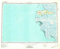
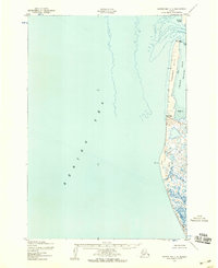
1953 Map of Hooper Bay
USGS Topo · Published 1963About this map
The coastal wetlands and coastal bluffs of the Yukon-Kuskokwim Delta are captured here during a period of mid-century aerial mapping and hydrographic study. The terrain is dominated by a complex network of waterways, including the Kashunuk River and Kun River, which meander through a landscape of tundra and small lakes. Rising above the lowlands, the Askinuk Mountains provide a dramatic landmark near the coast, terminating at the prominent Cape Romanzof. This 1950s record documents the established coastal settlement of Hooper Bay alongside Chevak and Old Chevak, showing the spatial relationship between these communities and their traditional hunting and fishing grounds. Navigation and transit across the delta are represented by various water bodies like Kokechik Bay and a Winter Trail stretching across the northern interior, illustrating how the landscape was traversed before modern infrastructure reached the region.
Find a feature on this map
43 named features on this map. Tap any name to fly to it.
Don’t see what you’re looking for? This feature index may not catch every label — zoom into the map to look around manually.
Map Details
Editions of this 1953 Hooper Bay Map
5 editions found

Other maps of this area

1951 · Marshall
USGS Topo · 1:250,000

1951 · Hooper Bay
USGS Topo · 1:250,000

1951 · Nunivak Island
USGS Topo · 1:250,000

1951 · Black
USGS Topo · 1:250,000

1951 · Baird Inlet
USGS Topo · 1:250,000

1952 · Kwiguk
USGS Topo · 1:250,000

1952 · Black A-2
USGS Topo · 1:63,360

1952 · Black A-1
USGS Topo · 1:63,360
1952 · Hooper Bay C-4
USGS Topo · 1:63,360

1952 · Kwiguk A-6
USGS Topo · 1:63,360