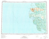
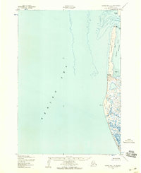
1953 Map of Hooper Bay
USGS Topo · Published 1977About this map
As Kinuk Mountains dominate the coastal topography of this remote Delta region, where the Bering Sea meets a complex network of tidewater rivers and sloughs. Based on surveys from the early 1950s, the map reveals a landscape defined by traditional Indigenous movement and subsistence, with primary settlements established at Hooper Bay and Scammon Bay. A Winter Trail connects these coastal outposts to inland points like Chevak and Paimiut, illustrating the seasonal transportation routes vital to life in the Clarence Rhode National Wildlife Range. The intricate waterway system, including the Kun River and Kushunuk River, flows through a marshy expanse punctuated by features like Castle Hill and Cape Romanzof. This survey documents a critical period of geographic recording for the area, capturing the transition between ancestral sites like Old Chevak and more modern population centers.
Find a feature on this map
53 named features on this map. Tap any name to fly to it.
Don’t see what you’re looking for? This feature index may not catch every label — zoom into the map to look around manually.
Map Details
Editions of this 1953 Hooper Bay Map
5 editions found

Other maps of this area

1951 · Marshall
USGS Topo · 1:250,000

1951 · Hooper Bay
USGS Topo · 1:250,000

1951 · Nunivak Island
USGS Topo · 1:250,000

1951 · Black
USGS Topo · 1:250,000

1951 · Baird Inlet
USGS Topo · 1:250,000

1952 · Kwiguk
USGS Topo · 1:250,000

1952 · Black A-2
USGS Topo · 1:63,360

1952 · Black A-1
USGS Topo · 1:63,360
1952 · Hooper Bay C-4
USGS Topo · 1:63,360

1952 · Kwiguk A-6
USGS Topo · 1:63,360