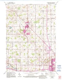
1954 Map of Howards Grove
USGS Topo · Published 1995About this map
Howards Grove serves as the central hub of this Wisconsin landscape, where several roads converge in a pattern of rural development that defined the mid-century Sheboygan area. The terrain is defined by the winding paths of Sevenmile Creek and the Pigeon River, alongside the Sheboygan River further south. For those tracing local heritage, the map is remarkably dense with 19th-century educational and religious landmarks, ranging from the Trinity Sch and Haven Sch to the St Paul-Friedhof Cem. Significant infrastructure such as the Sheboygan County Memorial Airport and Interchange 123 illustrates the modernization occurring alongside traditional settlements like Erdman and Kohler. Revisions from the early 1990s are captured in purple, highlighting the outward growth of residential areas into former farmland.
Find a feature on this map
34 named features on this map. Tap any name to fly to it.
Don’t see what you’re looking for? This feature index may not catch every label — zoom into the map to look around manually.
Map Details
Editions of this 1954 Howards Grove Map
3 editions found

Other maps of this area

1954 · Sheboygan Falls
USGS Topo · 1:62,500

1954 · Sheboygan South
USGS Topo · 1:62,500

1954 · School Hill
USGS Topo · 1:24,000

1954 · Sheboygan Falls
USGS Topo · 1:24,000

1954 · Cleveland
USGS Topo · 1:24,000

1954 · St. Wendel
USGS Topo · 1:24,000

1954 · Sheboygan North
USGS Topo · 1:62,500

1954 · Sheboygan North
USGS Topo · 1:24,000

1954 · Sheboygan South
USGS Topo · 1:24,000

1954 · Howards Grove
USGS Topo · 1:62,500