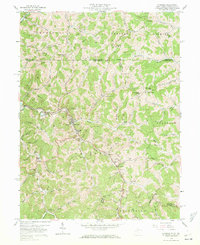
1958 Map of Hundred
USGS Topo · Published 1972About this map
The town of Hundred serves as a central hub along the Baltimore and Ohio rail line as it snakes through the winding creek valleys of northern Wetzel County. This late-1950s landscape is characterized by a dense network of upland ridges and narrow hollows, where small settlements like Burton, Cottontown, and Garrison are connected by miles of ridgeline pipelines and telephone lines. The mapping reveals a rural community deeply rooted in family history, evidenced by numerous private and church graveyards such as Earnshaw Cem and McNicholas Cem.
Find a feature on this map
84 named features on this map. Tap any name to fly to it.
Don’t see what you’re looking for? This feature index may not catch every label — zoom into the map to look around manually.
Map Details
Editions of this 1958 Hundred Map
3 editions found
Other maps of this area

1903 · Littleton
USGS Topo · 1:62,500

1904 · Cameron
USGS Topo · 1:62,500

1905 · Mannington
USGS Topo · 1:62,500

1905 · Rogersville
USGS Topo · 1:62,500

1905 · Littleton
USGS Topo · 1:62,500

1923 · Mannington
USGS Topo · 1:62,500

1924 · Littleton
USGS Topo · 1:62,500

1926 · Littleton
USGS Topo · 1:62,500

1926 · Mannington
USGS Topo · 1:62,500

1935 · Cameron
USGS Topo · 1:62,500