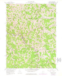
1958 Map of Hundred
USGS Topo · Published 1977About this map
The Baltimore and Ohio RR snakes through the tight valley floor of Wetzel County, serving the town of Hundred, which sits at the confluence of several vital runs. This 1958 survey, updated in 1976, shows a landscape defined by the extraction of oil and gas, with numerous wells dotting the steep ridges between Fish Creek and the North Fork. Engineering feats like the Marshall Tunnel and Sales Tunnel illustrate the challenges of maintaining rail infrastructure through the region's dissected topography.
Find a feature on this map
88 named features on this map. Tap any name to fly to it.
Don’t see what you’re looking for? This feature index may not catch every label — zoom into the map to look around manually.
Map Details
Editions of this 1958 Hundred Map
3 editions found
Other maps of this area

1903 · Littleton
USGS Topo · 1:62,500

1904 · Cameron
USGS Topo · 1:62,500

1905 · Mannington
USGS Topo · 1:62,500

1905 · Rogersville
USGS Topo · 1:62,500

1905 · Littleton
USGS Topo · 1:62,500

1923 · Mannington
USGS Topo · 1:62,500

1924 · Littleton
USGS Topo · 1:62,500

1926 · Littleton
USGS Topo · 1:62,500

1926 · Mannington
USGS Topo · 1:62,500

1935 · Cameron
USGS Topo · 1:62,500