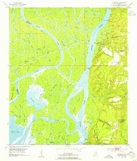
1953 Map of Hurricane
USGS Topo · Published 1954About this map
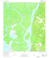
Civil War Trenches line the bluffs overlooking the Mobile River delta, marking a landscape where military history and a complex riverine economy intersect. The terrain transitions sharply from the deep, swampy lowlands of Chuckfee Bay and Gravine Island to the elevated ground of Stony Hill. This 1953 revision documents a network of landings such as Perkins Landing and Sizemore Landing that served the local timber and river trade. Inland, the Louisville and Nashville railroad passes through Ortiz Siding, providing a vital transit link parallel to the delta. Local life is anchored by community landmarks like St Johns Ch, Magnolia Ch, and the Blakeley Sch, while several family burial grounds, including Miller Cem and Wilkins Cem, offer significant genealogical data for researchers. The map also captures the intricate maze of bayous, such as Big Bayou Canot and Alligator Bayou, which defined the delta's navigation and drainage patterns before modern alterations.
Find a feature on this map
60 named features on this map. Tap any name to fly to it.
Don’t see what you’re looking for? This feature index may not catch every label — zoom into the map to look around manually.
Map Details
Editions of this 1953 Hurricane Map
6 editions found
Other maps of this area

1921 · Fairhope
USGS Topo · 1:62,500

1922 · Mobile
USGS Topo · 1:62,500

1940 · Mobile
USGS Topo · 1:31,680

1940 · Mobile
USGS Topo · 1:62,500

1941 · Chickasaw
USGS Topo · 1:31,680

1941 · Blakeley
USGS Topo · 1:31,680

1941 · Bay Minette
USGS Topo · 1:62,500

1941 · Creola
USGS Topo · 1:62,500

1941 · Fairhope
USGS Topo · 1:62,500

1942 · Hurricane
USGS Topo · 1:31,680