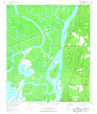
1953 Map of Hurricane
USGS Topo · Published 1968About this map
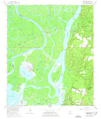
Civil War Trenches preserved on the high ground east of the river system highlight the strategic military importance of this Baldwin County landscape during the mid-19th century. This 1953 survey, with updates from late 1960s aerial photography, reveals a complex aquatic environment where the Mobile River, Tensaw River, and Raft River diverge into a labyrinth of bayous and islands. The community of Hurricane sits near the tracks of the Nashville and Louisville railroad, which cuts across the marshland toward Ortiz Siding. Inland, the map documents a network of rural institutions, including Magnolia Church, St Johns Church, and the Blakeley School. Several family cemeteries like Miller Cem and Wilkins Cem are recorded near Whitehouse Creek, providing valuable touchpoints for genealogists tracing the early residents of this river-centered economy.
Find a feature on this map
58 named features on this map. Tap any name to fly to it.
Don’t see what you’re looking for? This feature index may not catch every label — zoom into the map to look around manually.
Map Details
Editions of this 1953 Hurricane Map
6 editions found
Other maps of this area

1921 · Fairhope
USGS Topo · 1:62,500

1922 · Mobile
USGS Topo · 1:62,500

1940 · Mobile
USGS Topo · 1:31,680

1940 · Mobile
USGS Topo · 1:62,500

1941 · Chickasaw
USGS Topo · 1:31,680

1941 · Blakeley
USGS Topo · 1:31,680

1941 · Bay Minette
USGS Topo · 1:62,500

1941 · Creola
USGS Topo · 1:62,500

1941 · Fairhope
USGS Topo · 1:62,500

1942 · Hurricane
USGS Topo · 1:31,680