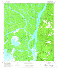
1953 Map of Hurricane
USGS Topo · Published 1964About this map
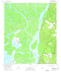
Civil War Trenches line the eastern bluffs overlooking the vast delta system where the Mobile River and Tensaw River converge. This 1953 survey captures a landscape defined by its complex hydrology, featuring numerous bayous and lakes like Lizard Lake and Chuckfee Bay. The settlement at Hurricane and several river landings, such as Perkins Landing and Sizemore Landing, reflect a river-and-rail economy anchored by the Louisville and Nashville railroad crossing. On the higher ground to the east, the social fabric of the era is preserved through numerous family and community landmarks, including Miller Cem, Blakely Sch, and several rural churches. The presence of military earthworks along the ridge provides a tangible link to 19th-century history within a mid-20th-century topographic context.
Find a feature on this map
52 named features on this map. Tap any name to fly to it.
Don’t see what you’re looking for? This feature index may not catch every label — zoom into the map to look around manually.
Map Details
Editions of this 1953 Hurricane Map
6 editions found
Other maps of this area

1921 · Fairhope
USGS Topo · 1:62,500

1922 · Mobile
USGS Topo · 1:62,500

1940 · Mobile
USGS Topo · 1:31,680

1940 · Mobile
USGS Topo · 1:62,500

1941 · Chickasaw
USGS Topo · 1:31,680

1941 · Blakeley
USGS Topo · 1:31,680

1941 · Bay Minette
USGS Topo · 1:62,500

1941 · Creola
USGS Topo · 1:62,500

1941 · Fairhope
USGS Topo · 1:62,500

1942 · Hurricane
USGS Topo · 1:31,680