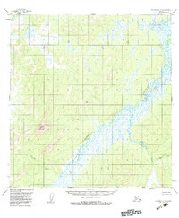
1954 Map of Iditarod A-6
USGS Topo · Published 1983About this map
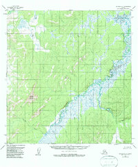
The Iditarod River carves a winding path through this Interior Alaska landscape, documented through aerial photography in the early 1950s. The terrain is defined by low-lying wetlands and significant relief features like Mosquito Mountain and the high point at VABM 1079 Montana. A dense network of drainage systems feeds into the main river channel, including American Creek, Rainy Creek, and Montana Creek. The survey reveals a wilderness area without established roads or settlements at the time of field annotation in 1954, highlighting the isolation of the region between the Reindeer R and the Smith Creek drainage. The map's contour lines and swamp symbols illustrate a complex hydrology where numerous small tributaries like State Creek and Little Creek navigate the shifting elevations of the Iditarod quadrangle.
Find a feature on this map
14 named features on this map. Tap any name to fly to it.
Don’t see what you’re looking for? This feature index may not catch every label — zoom into the map to look around manually.
Map Details
Editions of this 1954 Iditarod A-6 Map
3 editions found

Other maps of this area

1947 · Russian Mission
USGS Topo · 1:250,000

1950 · Russian Mission
USGS Topo · 1:250,000

1950 · Sleetmute
USGS Topo · 1:250,000

1951 · Holy Cross
USGS Topo · 1:250,000

1951 · Iditarod
USGS Topo · 1:250,000

1952 · Holy Cross A-1
USGS Topo · 1:63,360

1952 · Holy Cross B-1
USGS Topo · 1:63,360

1952 · Holy Cross
USGS Topo · 1:250,000

1952 · Russian Mission D-1
USGS Topo · 1:63,360
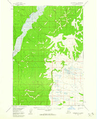
1954 · Sleetmute D-8
USGS Topo · 1:63,360