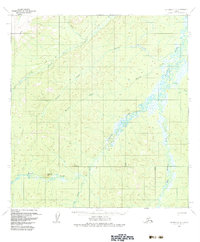
1954 Map of Iditarod C-2
USGS Topo · Published 1983About this map
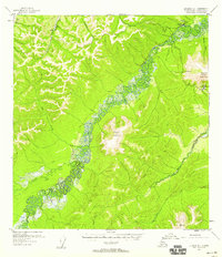
The Takotna River winds through this interior Alaskan landscape, defining the drainage patterns of a region primarily characterized by its remote waterways and significant peaks. Mapping based on mid-1950s aerial photography shows a land organized by the flow of the Big Waldren Fork and the Little Fork Waldren Fork, with prominent landmarks like Wolf Mountain and Sugarloaf Mountain rising above the creek beds. Human activity is sparsely marked by an isolated Cabin along the river and a network of primitive routes labeled as Trail, Summer Trail, and Winter Trail, reflecting the seasonal nature of travel in the subarctic. Dozens of named tributaries, including Fourth of July Creek, Bonnie Creek, and Minnie Creek, highlight the topographic detail captured by the Geological Survey during this post-war era of aerial mapping.
Find a feature on this map
18 named features on this map. Tap any name to fly to it.
Don’t see what you’re looking for? This feature index may not catch every label — zoom into the map to look around manually.
Map Details
Editions of this 1954 Iditarod C-2 Map
4 editions found
Other maps of this area

1951 · Iditarod
USGS Topo · 1:250,000

1954 · Iditarod B-1
USGS Topo · 1:63,360

1954 · Iditarod B-2
USGS Topo · 1:63,360

1954 · Iditarod C-3
USGS Topo · 1:63,360

1954 · Iditarod B-3
USGS Topo · 1:63,360

1954 · Iditarod C-2
USGS Topo · 1:63,360

1954 · Iditarod D-2
USGS Topo · 1:63,360

1954 · Iditarod D-3
USGS Topo · 1:63,360
1954 · Iditarod D-1
USGS Topo · 1:63,360
1955 · Iditarod D-1
USGS Topo · 1:63,360