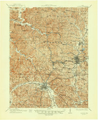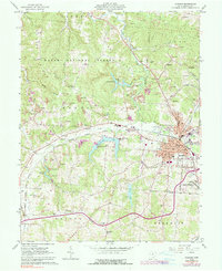
1961 Map of Jackson
USGS Topo · Published 1990About this map
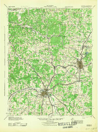
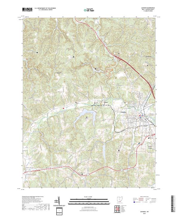
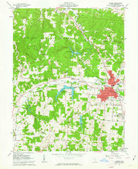
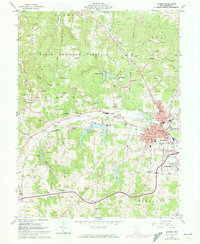
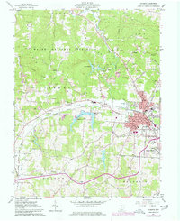
Jackson serves as the industrial and civic anchor of this Appalachian foothills landscape, where three major rail lines—the Baltimore and Ohio, Chesapeake and Ohio, and Detroit Toledo and Ironton—converge to serve the region's extraction economy. The map reveals a transition between the dense street grid of the county seat and the surrounding Wayne National Forest, where steep ridges like McCune Ridge and Pine Ridge are marked by extensive strip mining operations. Outside the urban core, small outlying settlements like Sharon and Jackson Heights are visible, alongside rural spiritual centers such as Beeterman Chapel and Valley Chapel. Hydrology plays a central role in the terrain, with Hammertown Lake and Lake Katherine providing significant water features north of the Buckeye Swamp. This survey documents a mid-century balance between traditional forest land and the intensive surface mining that reshaped the hillsides during this era.
Find a feature on this map
55 named features on this map. Tap any name to fly to it.
Don’t see what you’re looking for? This feature index may not catch every label — zoom into the map to look around manually.
Map Details
Editions of this 1961 Jackson Map
5 editions found

Historical Maps of Jackson Through Time
8 maps found