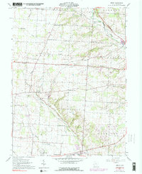
1961 Map of Jersey
USGS Topo · Published 1984About this map
The South Fork Licking River and its many tributaries, including the Muddy Fork Licking River and Blacklick Creek, define the topography of this central Ohio landscape. The map reveals a transition from the agricultural hamlets of Jersey and Columbia Center to the more developed southern corridor near Pataskala. Local history is deeply etched into the rural grid through a series of family-named intersections like Hazelton Corners, Tylers Corners, and Millers Corners.
Find a feature on this map
38 named features on this map. Tap any name to fly to it.
Don’t see what you’re looking for? This feature index may not catch every label — zoom into the map to look around manually.
Map Details
Editions of this 1961 Jersey Map
Other maps of this area

1902 · Westerville
USGS Topo · 1:62,500

1904 · Westerville
USGS Topo · 1:62,500

1907 · Thurston
USGS Topo · 1:62,500

1908 · Granville
USGS Topo · 1:62,500

1909 · Thurston
USGS Topo · 1:62,500

1910 · Granville
USGS Topo · 1:62,500

1925 · East Columbus
USGS Topo · 1:62,500

1943 · East Columbus
USGS Topo · 1:62,500

1947 · Columbus
USGS Topo · 1:250,000

1950 · Marion
USGS Topo · 1:250,000