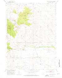
1953 Map of Johnson Mountain
USGS Topo · Published 1976About this map
Johnson Mountain dominates the central landscape of this mid-century survey, a topographic landmark rising above the intricate drainage networks of Rabbit Creek and South Fish Creek. The area reflects a localized ranching economy concentrated along the North Laramie River and Dry Laramie River corridors, where several family holdings including Butner Ranch, Tatman Ranch, and Morrison Ranch are established. A notable cluster of rural infrastructure appears in the south, centered around the Sommers-Shockley School, which served the scattered homesteads of the basin.
Find a feature on this map
33 named features on this map. Tap any name to fly to it.
Don’t see what you’re looking for? This feature index may not catch every label — zoom into the map to look around manually.
Map Details
Editions of this 1953 Johnson Mountain Map
4 editions found
Other maps of this area

1943 · Esterbrook
USGS Topo · 1:62,500

1945 · Esterbrook
USGS Topo · 1:62,500

1950 · Coleman Butte
USGS Topo · 1:24,000

1950 · Cottonwood Falls
USGS Topo · 1:24,000

1951 · Coleman Butte
USGS Topo · 1:24,000

1951 · Cottonwood Falls
USGS Topo · 1:24,000

1953 · Lewis Flat
USGS Topo · 1:24,000

1953 · Hightower
USGS Topo · 1:24,000

1953 · Hightower SW
USGS Topo · 1:24,000

1953 · Johnson Mountain
USGS Topo · 1:24,000