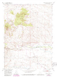
1953 Map of Johnson Mountain
USGS Topo · Published 1985About this map
The high ranching country of Platte County unfolds across this 1953 survey, dominated by the massive profile of Johnson Mountain and the surrounding Medicine Bow National Forest. The landscape is defined by its water management and livestock history, with the North Laramie River and Dry Laramie River carving through the terrain, supported by man-made infrastructure like the Laramie Canal and Merkel Ditch.
Find a feature on this map
29 named features on this map. Tap any name to fly to it.
Don’t see what you’re looking for? This feature index may not catch every label — zoom into the map to look around manually.
Map Details
Editions of this 1953 Johnson Mountain Map
4 editions found
Other maps of this area

1943 · Esterbrook
USGS Topo · 1:62,500

1945 · Esterbrook
USGS Topo · 1:62,500

1950 · Coleman Butte
USGS Topo · 1:24,000

1950 · Cottonwood Falls
USGS Topo · 1:24,000

1951 · Coleman Butte
USGS Topo · 1:24,000

1951 · Cottonwood Falls
USGS Topo · 1:24,000

1953 · Lewis Flat
USGS Topo · 1:24,000

1953 · Hightower
USGS Topo · 1:24,000

1953 · Hightower SW
USGS Topo · 1:24,000

1953 · Johnson Mountain
USGS Topo · 1:24,000