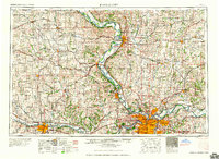
1960 Map of Kansas City
USGS Topo · Published 1960About this map
The confluence of the Missouri River and the Kansas River serves as the focal point for this mid-century survey of the sprawling Kansas City metropolitan area. The landscape is defined by its deep connectivity, with the Union Pacific RR and Atchison Topeka & Santa Fe RR radiating from the urban core toward Topeka and Saint Joseph. Beyond the industrial and commercial centers of Kansas City and Independence, the map reveals a significant military and indigenous presence. The Fort Leavenworth Military Reservation and the Lake City Arsenal reflect the region's strategic importance, while the Kickapoo Indian Reservation and Pottawatomie Indian Reservation mark the enduring tribal lands of northeast Kansas. Recreational areas like Lake Jacomo and Lewis and Clark State Park dot the river-carved terrain, providing a look at the region's post-war development and early suburban expansion.
Find a feature on this map
228 named features on this map. Tap any name to fly to it.
Don’t see what you’re looking for? This feature index may not catch every label — zoom into the map to look around manually.
Map Details
Editions of this 1960 Kansas City Map
3 editions found

Other maps of this area

1885 · Eskridge
USGS Topo · 1:125,000

1885 · Warrensburg
USGS Topo · 1:125,000

1885 · Atchison
USGS Topo · 1:125,000

1885 · Lawrence
USGS Topo · 1:125,000

1886 · Oskaloosa
USGS Topo · 1:125,000

1887 · Harrisonville
USGS Topo · 1:125,000

1887 · Olathe
USGS Topo · 1:125,000

1887 · Warrensburg
USGS Topo · 1:125,000

1888 · Oskaloosa
USGS Topo · 1:125,000

1888 · Atchison
USGS Topo · 1:125,000